Overview
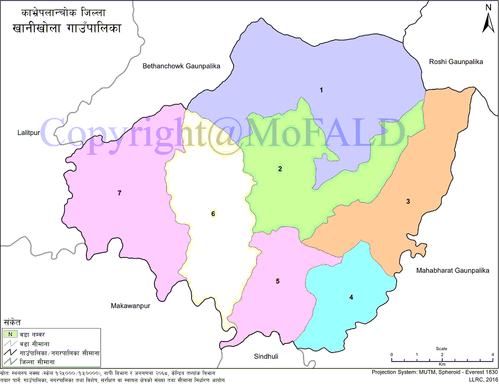
Khanikhola Rural Municipality (खानीखोला गाउँपालिका, काभ्रेपलाञ्चोक) formed with including former 7 Wards (Falameter-1, Falameter-2, Dandagaun-3, Dandagaun-4, Salmechakal-5, Saldhara-6, Milche-7) and declared Khanikhola Gaupalika by the name of holy Khanikhola (2073 Falgun 2 [10 March 2017]). In the context of modern Nepal, the Terai, known as the hillside of Kavre, is known as the Chakal. Khanikhola Rural Municipality is located at a distance of 125 km from the capital and is known as a cool, quiet, pollution-free, and green Khanikhola.
The 2068 BS (2011 AD) census has a population of 14,398 and covers an area of 132 sq. Km. Spread over an area and carrying all kinds of natural diversity, this village is a great example of Chinese in terms of history and tourism. Overcoming the challenges under the Rural Municipality, this Khanikhola Gaupalika is rapidly moving towards development.
Geographical Map of Khanikhola Rural Municipality:
Contact Address:
Location: Salmechakala, Kavrepalanchok, Bagmati Pradesh, Nepal
Telephone: +977-9851253491
Email: khanikholamun@gmail.com
Website: www.khanikholamun.gov.np


