Overview
Looking at the green hills and Jugal and Gauri Shankar Himal, Tripurasundari Rural Municipality (त्रिपरासुन्दरी गाउँपालिका, सिन्धुपाल्चोक) located in the Sindhupalchok district of the Bagmati Zone of the Central Development Region under the Bagmati Pradesh. The total area of Trpurasundari Gaupalika is 94.28 sq. Km. Is. It occupies 0.064 percent of Nepal's territory.
This village municipality is 83.6 km from Kathmandu. North East, 50 km from Chaitara. 2 km from East and Barhabise Bazaar. It is located in the southeast. The village is named after the thousand-year-old Tripurasundari temple in Taithali. The village has six VDCs and the former ward no., Tauthali (1-9), and Tekanpur (1-9) VDC. Were inaugurated on the 2nd of Chaitra 2073 BS. According to the Household Survey Base Year 2075 BS, the total number of households here is 4,233. It is home to followers of various religions such as Hindus, Buddhists, and Christians.
There is a friendly mix of different castes like Brahman, Chhetri, Thami, Tamang, Sherpa, Bhujel, Vishwakarma, Nepali, Magar, Gharti, etc. The main language here is Nepali, Newari, and other languages are also spoken. The beautiful village of Tripura warmly welcomes you with its beautiful natural scenery and a distinct identity through the river channels.
Location: 27.792 to 27.705 north latitude and 85.861 to 86.034 east longitude.
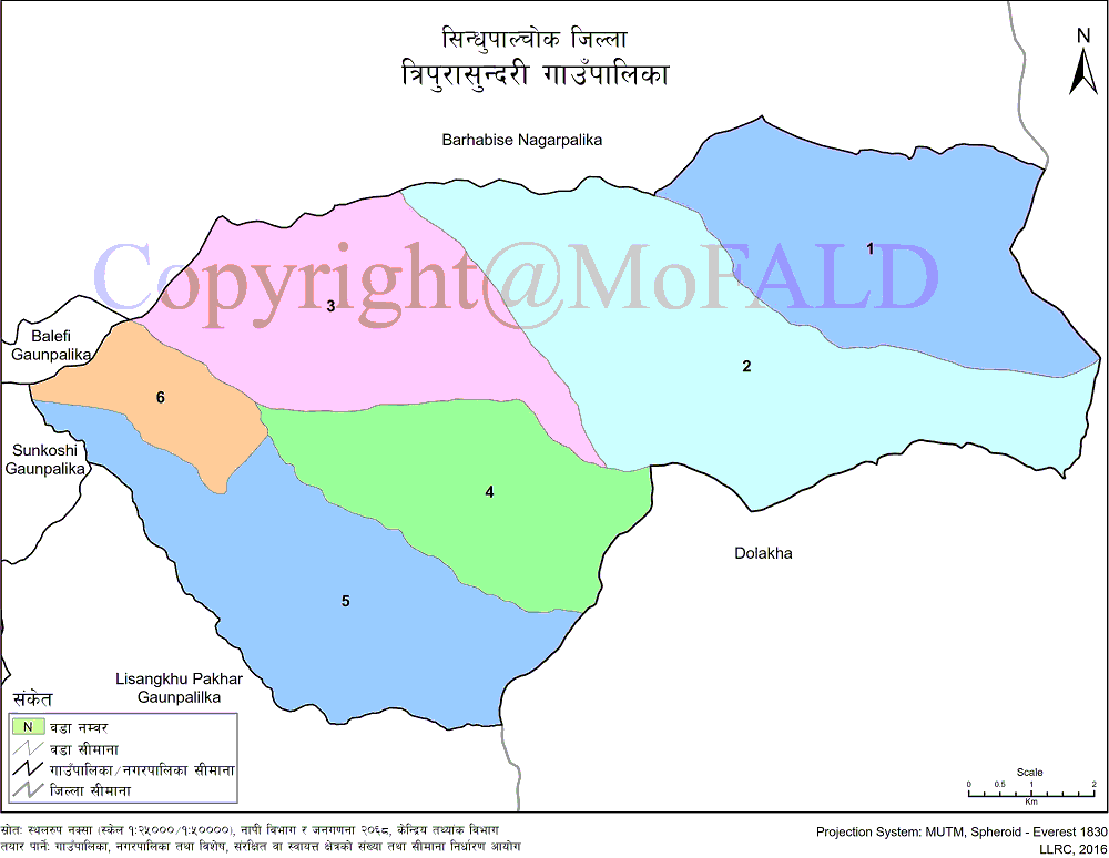
Geographical Map of Tripurasundari Rural Municipality, Sindhupalchok:
Contact Address:
Location: Piskar, Sindupalchok, Bagmati Pradesh, Nepal
Telephone: +977-1-6201663, +977-1-6201662
Email: tripurasundarisipa@gmail.com
Website: www.tripurasundarimunsindhupalchowk.gov.np


